Saturday, May 21, 2011

The passing of La Nina


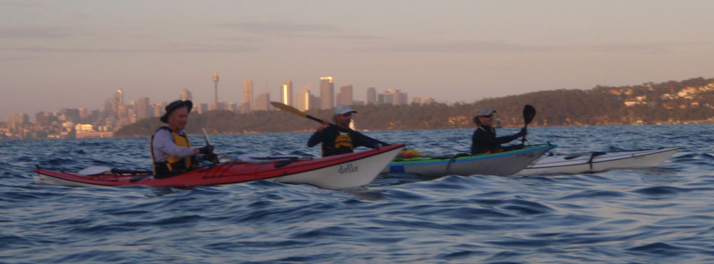
The sea surface temperatures along our coastline are returning to more typical ranges for late autumn. The skies are clearing and conditions for kayaking are once again superb.

Peter in his backyard.

Paddling into shore at Salmon Cove, we lit a fire amongst the driftwood and cooked a breakfast in celebration of Peter's birthday. A very large New Zealand fur seal was hunting along the shore, occassionally waving its glossy black flippers at us as we soaked up the sunshine and the extraordinary view towards the horizon.

Wednesday, May 4, 2011

The specifics of place


Indigenous Australian "canoe tree"
(Photo Margaret Zommers)

Sunday, March 20, 2011

Paddle culture

The group of islands (1 very large, 1 moderate and lots of small) that constitute this place known as Australia have a total length of coastline of approximately 59,736 km.
( Mainland = 35,877 km + Islands = 23,859 km )
Source: Australian Geoscience.

So it's not surprising to find that the groups of indigenous people who lived along these extensive and varied coastal environments for tens of thousands of years developed a culture with a great variety of marine craft for travelling, hunting and gathering.


The elegant drawing by David Payne (reproduced with permission above) represents just some of the documented types of indigenous paddle (and sail) craft known to have existed at the time of British colonisation and shortly thereafter. No doubt there would have been still more designs that escape our knowledge. They have not survived the limited timespan available to organic materials and have disappeared back into the soil from which their constituent elements were derived, along with their original paddlers.

According to Historian Keith Vincent Smith, the indigenous people of Sydney Harbour - the Eora - were a canoeing culture. Indeed during the earliest days of British settlement there are reports of observing more than 90 indigenous paddle craft on the harbour in a single day.
Paddling was a central aspect to indigenous coastal culture.

Tuesday, March 15, 2011

The blue field

South along the cliffs to Botany Bay ...


"I'm on!"

"Me too!"


Sunday, February 20, 2011

Sea way

It is interesting to think about how the land-based circulation pattern of our street systems frames our understanding of the city's topography / landscape and in turn this shapes our understanding about how we move through the landscape. For example, to travel from Manly to Watsons Bay one doesn't think twice about driving 25+kms via Kirribilli.
.
Of course it was not always like this. The Eora were a canoeing culture and their use of the harbour as a broad field for moving across meant that a trip from one side of the harbour to the other was unlimited - except by the constraints of weather.

The obvious opportunity for better connecting many otherwise seemingly dis-connected places strung out along the harbour is via the branching network of our water ways. Ferry-catchers know this well.

This morning I paddled from Clovelly (on the coast) to a function at Balmoral (on lower-middle harbour) with my kayak. My family travelled by car using the road system.

Paddling along the coast, the sea way was free of all other traffic.
Four bonito were caught on the lure that I usually troll on trips such as this. I was hoping for the brilliant yellow flash of a kingfish - but no such luck today.

This was the view for the four bonito (before I threw them back).

It took about 2 hours to paddle the sea way from Clovelly to Balmoral (inclusive of down-time for pulling in the fish). The road way took about 1/4 of that time. I know which way I prefer.

Despite their apparent dis-connection, Clovelly and Balmoral are actually linked.


Wednesday, January 26, 2011

La NiƱa


This morning the harbour and its outside coast line were obscurred by clouds of very moist air.
The typically golden sandstone of North Head was unfamiliar in this dark atmospheric cloak.
And the short journey around to Shelly Beach was accompanied by the feeling that we were paddling along a foreign coastline.

The large-scale physical condition that seems to be driving this localised humid atmosphere (and the significant rainfall experienced recently along much of the east coast of Australia) is the embodied heat energy of the sea water in the western Pacific. As the diagram below from the CSIRO describes, we have a La NiƱa event in full-blown occurence ... 


At least the Bonito seem to like the warmer water.


On the return journey to the harbour the clouds of moisture continued to tumble over the face of North Head like a slow-motion waterfall. (Peter's sail just visible on the left)

Click on the Sea Surface Temperature chart (to the right) to see the cell of hot water that is circulating east of Sydney at the moment.
NOTE - if you're reading this posting many days after 26th January 2011then the cell of hot water will have evolved along its merry way to be replaced by some other body of cooler or warmer water.

Wednesday, October 20, 2010

J-Bay

The tribe has just returned from 3 days of kayaking at Jervis Bay.


A full trip report is available at:


Sunday, September 12, 2010

King cray

Tony does it again with another Sunday dinner pulled from Sydney's coastline ...

Sunday, August 22, 2010

More local tucker

Kingfisher just back on shore with his winter lunch sourced from the Sydney coastline.

Look and you shall find.

Monday, August 16, 2010

Harbour tucker

To the impressive list of recent finds that Tony has hunted and gathered in Sydney Harbour is this live scallop.
Abalone, bonito, crays, kingfish, octopus, oysters, mussels, prawns, (Australian) salmon, sea urchins, tailor and now a plump Port Jackson scallop.

Self-sufficiency based on an affinity with the harbour's natural habitats is a fine characteristic that once under-pinned the indigenous clans of this harbour.

Sunday, July 25, 2010

The north passage

An early departure.
Time that is moved by little fidget wheels
Between the double and the single bell
Is not my time, the flood that does not flow.
 
A setting moon.
Deep and dissolving verticals of light
Ferry the falls of moonshine down.

Channel marker.
In the moon's drench, that straight enormous glaze,
And ships far off asleep, and Harbour-buoys
Tossing their fireballs wearily each to each
(Excerpts from Five Bells. Kenneth Slessor.)


This morning's passage from Felix Bay on the lower harbour to the upper-most capillaries of Middle Harbour was done mostly in complete and beautiful darkness.
The timing of the passage coinciding with the peak of this morning's flood tide.

The images above and below are taken at East Killara and North Forestville where the salty Pacific Ocean of the harbour blurs into increasingly brackish channels and finally a fresh water creek.

The three narrow channels branching off into the valleys of Killara and Forestville are tightly enclosed by the trunks and canopies of tall trees crowding down to the water's edge.

The sky traces the creek's path through the tree canopies.

At Carrol Creek, in the Garigal National Park, the watery track is interrupted by a rock staircase, small waterfalls and rills. A kayak portage is required to get up to the creek that lies wholly above the high-tide level. It is completely fresh.

Quietly paddling into this extraordinary tributary of Sydney Harbour.


Drifting into the last navigable metres of Middle Harbour accompanied by birdsong and the overhanging parasols of tree ferns. The air temperature was low - my finger tips an alarming blue.